The appearance of a massive 400ft ice ship trapped within an Antarctic iceberg has captivated Google Earth users worldwide.
This amazing discovery shared through a YouTube video, has sparked curiosity and speculation about the origin and significance of the mysterious structure.
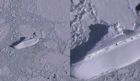
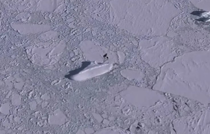
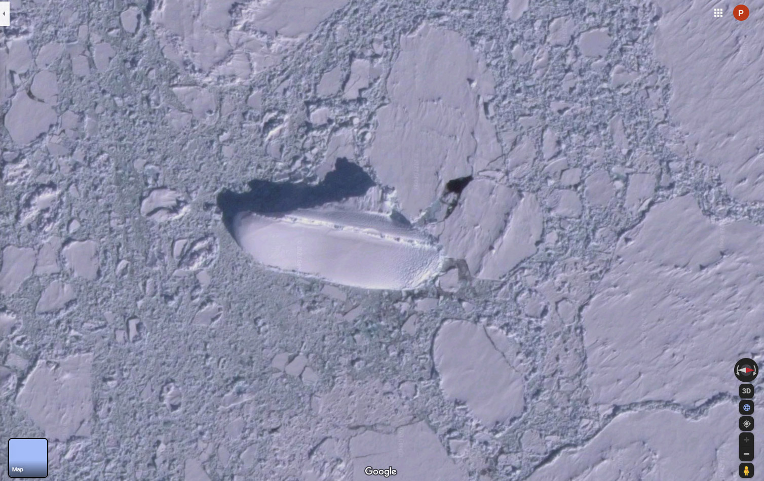
Google Earth users were taken aback when they stumbled upon a mysterious sight in Antarctica: A 400ft ice ship embedded in an iceberg.
The discovery has left internet users baffled and curious about the origins of this unusual find.
While exploring the vast expanse of Antarctica through the lens of Google Earth, users came across an icy mass resembling the shape of a boat.
The video showcased the massive structure, measuring over 400 feet in length and appearing to rise above the surrounding land.
In the video, MrMBB333 used the 3D view on Google Earth to get a better perspective, noting that the outline of the shape resembled that of a ship.
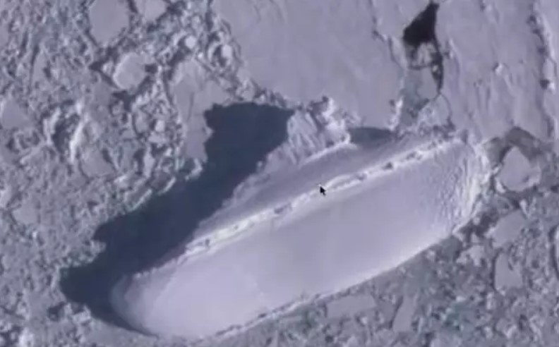
He humorously referred to it as an "ice ship" or a "400ft ship" stranded off the coast of Antarctica.
The coordinates 66°54'18.0"S 163°13'37.0" E were shared for those eager to explore the shape themselves.
Some suppose that the shape could be a remnant of a shipwreck, with receding ice possibly revealing long-buried wreckage.
Others have even linked it to the infamous Bermuda Triangle, suggesting that the ship may have been transported to Antarctica through some mysterious force.
However, its true shape remains a mystery.
While ships have indeed sunk in Antarctica in recent years, such as the MS Explorer in 2007 and the Lyubov Orlova in 2013, their locations do not align with the coordinates of the ice ship found on Google Earth.
Until someone can physically explore this enigmatic structure in Antarctica, it is likely to remain an interesting puzzle.
The discovery serves as a testament to the power of technology, allowing explorers to uncover unexplained phenomena on their technological devices.